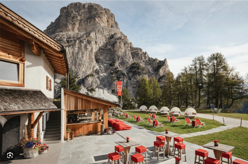
Stage 1.
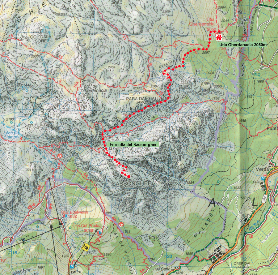
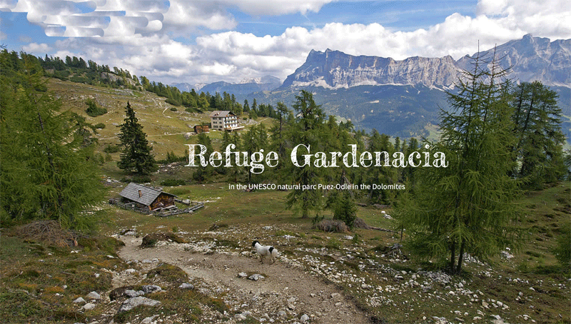
Corvara - Colfosco - Sassongher - Rifugio Gardenacia
Courtesy of Colletts.co.uk
| Day |
To |
Distance |
Time |
Elevation in meters |
| |
|
Km |
Elapsed
Hrs-Mins |
Moving
Hrs-Mins |
Gain |
Loss |
Max |
Min |
| 1 |
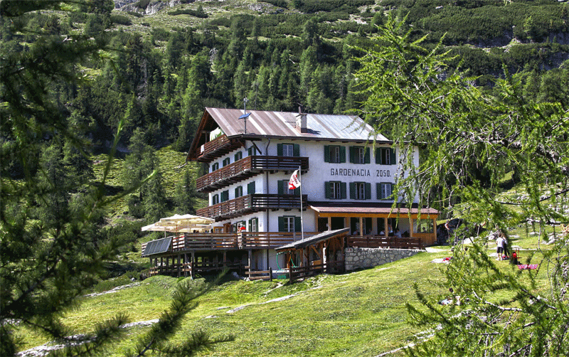
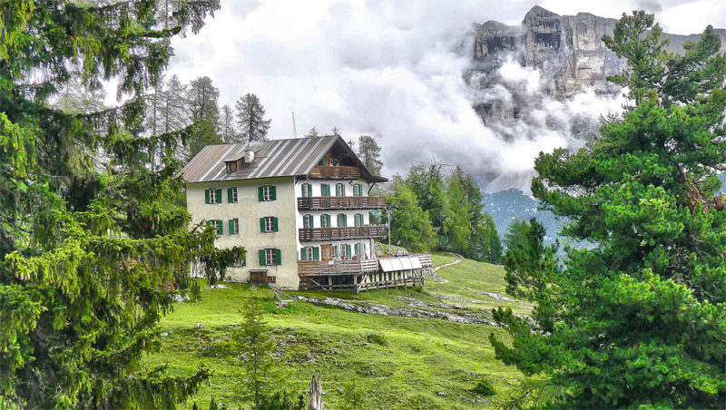
Corvara - Rifugio Gardenacia |
10.8 |
|
|
1,435 |
731 |
|
|
| 2 |
Rifugio Gardenacia - Rifugio Santa Croce |
12.9 |
|
|
955 |
950 |
|
|
| 3 |
Rifugio Santa Croce - Rifugio Lavarella |
12 |
|
|
1,188 |
1,150 |
|
|
| 4 |
Rifugio Lavarella - Rifugio Lagazuoi |
15 |
|
|
1,314 |
630 |
|
|
| 5 |
Rifugio Lagazuoi - Corvara |
14.8 |
|
|
769 |
1,390 |
|
|
| |
|
|
|
|
|
|
|
|
| |
Total |
65.5 |
|
|
5,661 |
4,851 |
|
|
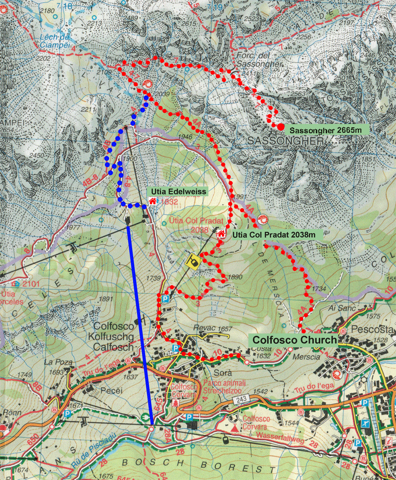
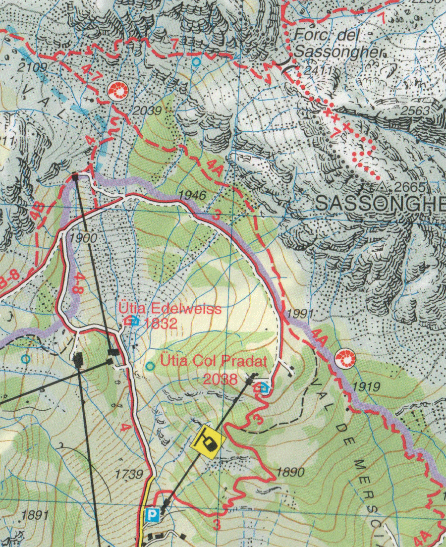
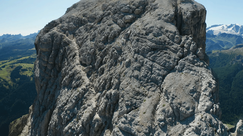
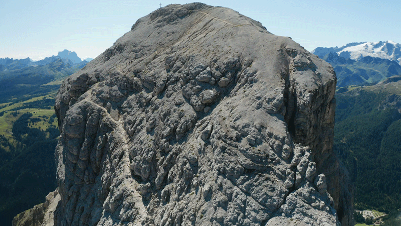
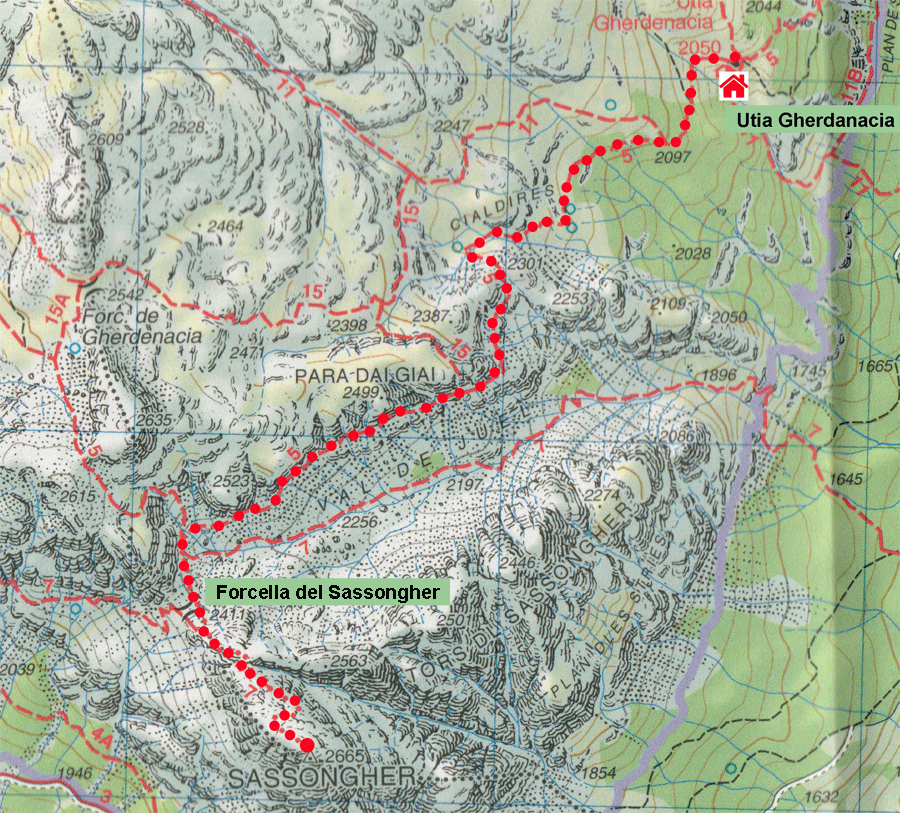
There are several options to get to the peak of Sassongher from Colfosco.
The first is to take Route 4A up to Utia Col Pradat at 2038m.
The second is to get to Col Pradat up Route 4, going under the chair lift at the start.
The third is starting from Rifugio Edelweiss at 1832m (which can be reached by cable car), to go up Route 4B until is reaches Route 4A. |
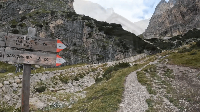
Colletts H8 Sassongher route description
- Path 4A North signposted Utia Col Pradat through the woods (Approx 1.5 km)
- At the junction continue along Path 4A signposted Sassongher (Approx 2.5 km)
- Path 7 East to the junction with Path 5 at Forcella dei Sassongher (Approx 2.5 km)...this path has long sections of exposure and is rocky underfoot throughout.
- Forcella dei Sassongher.... is where the final out-and-back to the summit starts. This includes a short section of exposed scrambling wheer cable aids your ascent. To reach the summit stay on Path 7 (south-east), and then return to Forcella dei Sassongher. (Approx 250m)
|
www.altabadia.org route description
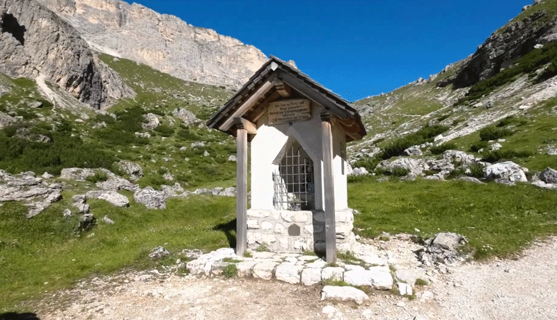
From the church in Colfosco, set off west through the Val Edelweiss valley on trail no. 4, going by the refuge and the tiny votive chapel until you reach a junction (or with the Col Pradat lift from Colfosco to the hill of the same name). Here, take trail no. 7 to Sassongher, going up over debris and rocky spurs to the Forcela Sassongher fork. From the pass, climb to the right once again, crossing a steep scree slope and some rocks with metal ropes, to arrive at the summit (3h 10min.). Come back down to the pass the same way. Leaving the Forcela Sassongher, descend northwards, to begin with on trail no. 7, but then on trail no. 5. This particular trail goes along an overhang below the sides of Para da Giai, ultimately arriving at the Gardenacia hut. Down to La Villa from the refuge, following trail no. 5, now going north-east. Cross several rocky overhangs then head downwards, over vast scree slopes until you are overlooking the Sponata hut at the chairlift station, which will take you to La Villa.
| Distance |
Time |
Elevation in meters |
Km |
Elapsed
Hrs-Mins |
Moving
Hrs-Mins |
Gain |
Loss |
Min |
Max |
| 11.6 |
4H27 |
|
1,303 |
1,464 |
1,475 |
2,664 |
|
|
|
|
|
|
|
|
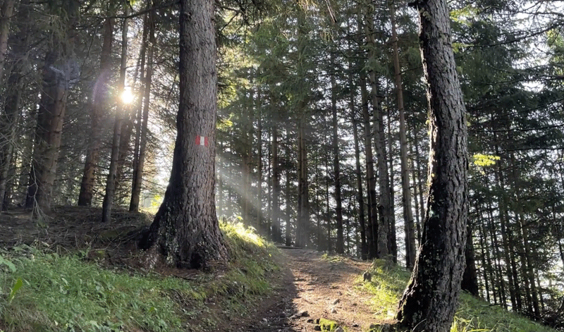
Through the woods on the climb to Rifugio Pradat
Utia Col Pradat at 2038m
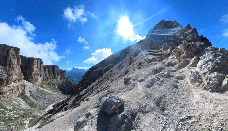
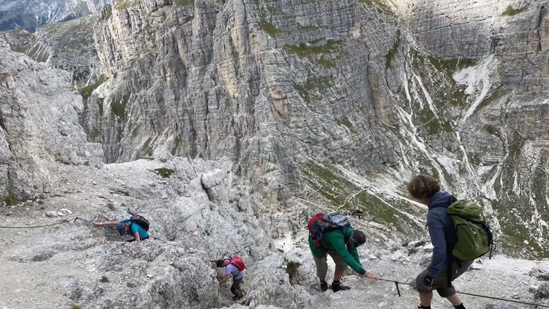
A well defined path but with exposure to the left
|
