Introduction
The Dolomites are a mountain range tucked in the NE corner of Italy near the border with Austria. Rather than them being a continuous crest or divide, they consist of many self contained groups of unique pale limestone rock formations that rise to dizzying heights, breathtaking sheer walls, high altitude plateaus including 18 peaks that rise to above 3,000 meters. The region is protected by the Dolomiti Bellunisi National Park and many other regional and natural parks and in August 2009 the Dolomites were declared a UNESCO World Heritage site. According to UNESCO, the sublime, monumental and colourful landscapes of the Dolomites feature some of the most beautiful mountain landscapes anywhere in the world. Their intrinsic beauty derives from a variety of vertical forms, such as pinnacles, spires, and towers with contrasting horizontal surfaces including ledges, crags and plateaus. Some of the rock cliffs here rise more than 1,500 meters, and are among the highest limestone walls found anywhere in the world.
Alta Via is the Italian for "High Route". In the Dolomites there are 8 of these long distance routes that traverse the Dolomites from top to bottom, north to south exploring spectacular regions of the different mountainous groups. Each trail takes one to two weeks to walk, and are served by numerous "refugi", Italian for huts. The first and most renowned route is "Alta Via 1", the perfect first experience for hiking in the Dolomites. Spread over about 8 to 9 days and 120 kilometers, and the high point of 2,752m, the Alta Via 1 is a straight forward yet astoundingly rewarding alpine experience. It wanders through the heart of the Dolomites and passes through some of the finest scenery in the entire range. |
(Introduction courtesy of Austin Lilleywhite)
The AV1 falls into three distinct parts by mountain groups:-
| |
Lago di Bràies to the Tofàne |
|
| |
Croda Rossa d’Ampezzo |
|
| |
Fànis |
|
| |
Tofàne |
|
| |
|
|
| |
The Tofàne to the Civetta |
|
| |
Nuvolàu |
|
| |
Croda da Lago |
|
| |
Pelmo |
|
| |
Civetta |
|
| |
|
|
| |
The Civetta to Belluno |
|
| |
Moiazza |
|
| |
Tàmer-San Sebastiano |
|
| |
Prampèr-Mezzodì |
|
| |
Schiara |
|
31 Refuges on or adjacent to the trail.
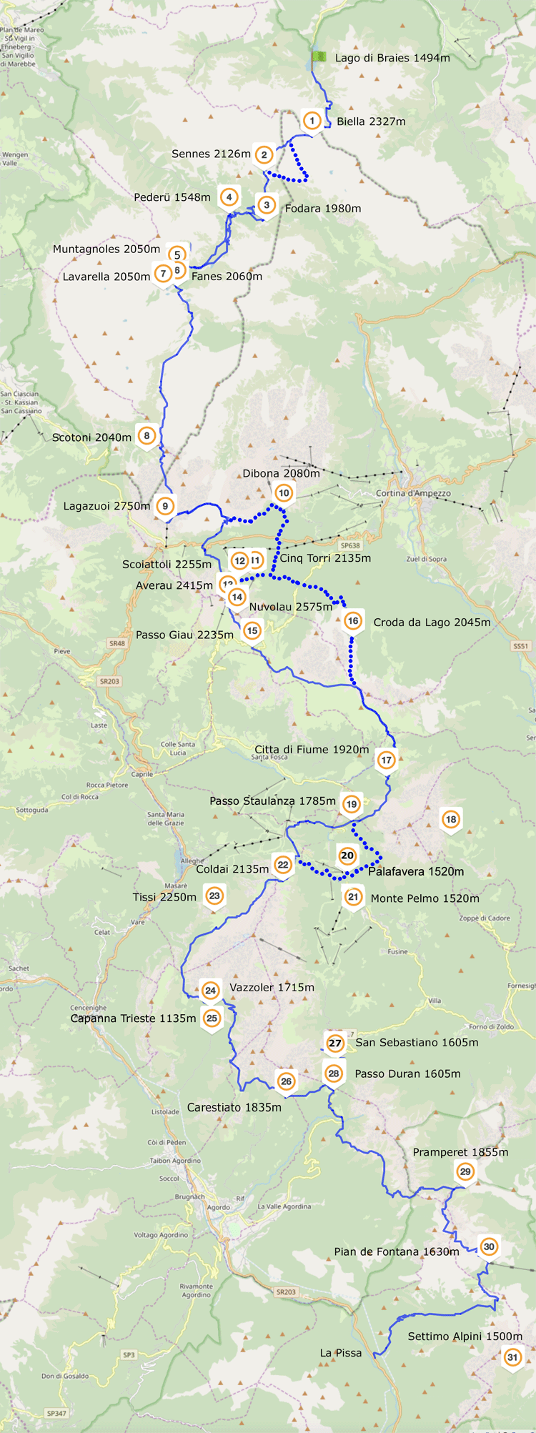
Alta Via 1.
Stage 1 . Lago di Braies to Rifugio Sennes
Stage 1. starts at the beautiful alpine lake, Lago di Braies, surrounded by towering peaks and pine forests. It begins with a steady climb to the first pass, Forcella Sora Forno (2,388m). On route you encounter several steep walls of rock that are surmounted by short but thrilling zig-zag routes aided by cables. At the pass you enter the Parco Naturale delle Dolomiti d’Ampezzo. The panorama from the broad meadowy pass is vast and breath taking, including the northern most Dolomite peaks, as well as the Marmolada, the Tofane peaks, and the Pelmo. From here the Alta Via 1 crosses some of the most breathtaking terrain, rolling and undulating meadows with far off views of Dolomite spires spread out around you as you re-enter the Parco Naturali Fanes-Sennes-Braies. From here you begin a steep descent into the rocky cleft of the Val di Tamersk, with its fascinating orange rock walls. The last portion of the stage involves a final extended uphill stretch that finishes in a beautiful alpine basin.
Stage 2. Rifugio Sennes to Rifugio Lagazuoi
On this stage the real highlights of the trip begin as you enter into the Cortina d’Ampezzo valley, cross one of the most thrilling passes of the entire trip and reach the trip's high point on the summit of Mount Lagazuoi. The stage begins through idyllic meadows, streams and rolling stony pastures and becomes more rocky and enthralling as the day goes on. The route heads for a dramatic notch between Cima di Lago and Punta di Fanes, the pass of Forcella del Lago (2,486M). from the top of the pass you are faced with a plunging stomach dropping gully. However the descent is made slowly but surely on reinforced switchbacks before a fantastic scree traverse over the picturesque alpine Lago di Lagazuoi. The stage closes with the stiff uphill climb to the summit of Mount Lagazuoi, which takes you over a lunar alpine landscape with ever improving jaw dropping views of the Cortina valley before you. At the top you reach the busy Rifugio Lagazuoi featuring one of the best and most expansive panoramas encountered on the Alta Via 1 and in the entire Dolomites.
Stage 3. Rifugio Lagazuoi to Rifugio Averau & Nuvolau
Stage 3. competes with the previous one for being the highlight of the entire trek as it takes you into the very heart of the Cortina valley at Rifugio Nuvolau, perhaps the most beautiful and spectacular spot on the entire trip. From Lagazuoi the Alta Via 1 embarks on a spectacularly scenic path, a somewhat exposed and thrilling traverse along the awesome southern flank of the massive Tofane di Rozes with excellent views across the Cortina valley. The Alta Via 1 then drops down into the valley briefly before making a climb to Rifugios Averau and Nuvolau. En route you pass the fascinating and famous Cinque Torri area, a centre for rock climbing and well worth a detour to explore the maze of the five rock towers. From the Cinque Torri you begin the steady climb to Averau & Nuvolau, yet another rocky alpine lunar landscape with ever improving views. Nuvolau is arguably the highlight of the entire trek located on a prominent summit in the very centre of the Cortina Dolomite with an unrivalled 360 degree panorama.
Stage 4. Rifugio Nuvolau to Rifuioi Città di Fiume
Stage 4 encounters an amazing variety of Dolomite landscapes. The stage begins with the most technically challenging and most exposed part of the entire route, a series of via ferrata or cable and ladder aided stretches to descend from Nuvolau to the valley. The cables come in two rounds and are over sheer vertical and exposed slabs of rock; thrilling and vertigo inducing but short. Here you descend the rest of the way to a road pass at the valley floor where you begin ascending once again to the grassy pass of Forcella Ambrizzola (2,277m) where you begin to bid farewell to the Cortina valley and head into a beautiful pasture amphitheater backed by the impressive Monte Pelmo looming up behind it. Here you descend through patches of forest before all of a sudden the Monte Pelmo rears up incredibly close at hand, nicknamed Throne of the Gods, with the refugio Città di Fiume situated just at the base of it. This massive mountain is isolated on all sides making it extremely prominent and making it recognisable from afar for its arm-chair shape.
Stage 5.Rifugoi Città di Fiume to Rifugio Tissi
Stage 5 makes a long and steep climb past the spectacularly situated Rifugio Coldai, where you enter the realms of another awesome stone giant, the Civetta. On route up the switchbacks you get some of the best vantage points to view the beautiful, massive Pelmo towering high above the valley. From Rifugio Coldai continue over to the beautiful Lago Coldai, perhaps the most beautiful alpine lake on the whole trek. From here finish the climb to the spectacularly situated Rifugio Tissi where you get divine technicolour sunsets, some of the best in the whole of the Dolomites. Located at the top of the hill, Cima di Col Rean, you get an absolutely dizzying birds eye view to the north, a sheer drop in the valley floor below you is Lago Alleghe and an incredibly memorable panorama to the north spreads out before you with Marmolada front and centre. Behind you and also astounding, are both the Civetta and the Pelmo. The Civetta is one of the most impressive Dolomite formations, shaped like an enormous trident, it rises sharply and majestically.
Stage 6. Rifugio Tissi to Rifugio Carestiato
From Tissi you descend gently through meadows across from the phenomenal Civetta. As you round the southern most corner of the Civetta you connect to the Moiazza which soars to 10,565 feet. From here you begin a steady but steep forested climb approaching the the thrilling somewhat exposed pass of Forcella Col dell'Orso (1,823m), situated along the amazing west wall of the Moiazza group. After this follows a brief short climb to Forcella del Camp (1,933m) and the breathtaking spectacle of the Molazza Sud and its countless spires. From here you descend and traverse through larch woods and scree before reaching Rifugio Carestiato (1,834m) where you are greeted with a new view, the San Sebastiano Tamer range to the south.
Stage 7. Rifugio Carestiato to Rifugio Pian de Fontana
Stage 7 begins by descending to a road pass where you enter the Parco Nationale Delle Dolomiti Belunissi which heads through quieter and less frequented places in the San Sebastiano Tamer group. En route you pass the Forcella Dagarei (1,620m) where the panorama is vast taking in the Cordevole valley. Alta Via 1 continues and after a short climb reaches a spectacular look out just before the Forcella del Moschesin (1,940m) where you take in the Cima de Zita and Talvena formations before you. From here you begin the ascent to one of the most difficult passes on the whole trip, the Forcella de Zita Sud (2,395m). This is one of the best sections on the Alta Via 1 and takes in the magnificent rugged scenery of the Dolomiti Belunissi. You enter a wonderfully rugged rocky alpine mountainside where you can admire the stunning panoramas to the north looking out on a sea of peaks with Pelmo, Monterau and Cerafees specially impressive. After a final steep slog you reach a narrow exposed rocky ridge. Here you have several steep exposed sections along this ridge which are short but not for the faint hearted. The pass is the gateway to one of the most beautiful valleys on the Alta Via 1, the Forcella de Zita de Fora. The descent is gentle at first but steepens down a grassy hillside before reaching the Rifugio Pian di Fontana.
Stage 8 Rifugio Pian de Fontana to La Pissa bus stop
This scenic conclusion to the Alta Via 1 crosses into the wild Val Vescova which is dominated by the marvellous Schiara formation rising dizzily to 8,714 feet. From the Rifugio Pian de Fontana you quickly drop down before a short but steady wooded ascent to the grassy balcony path of Forcella Lavarezza with plunging views down before you. After passing Rifugio Bianchet you enter a dramatic and beautiful ravine as you make the final descent into the Val Cordevole where the Alta Via 1 finishes at the La Pissa bus stop.
|
General description of the Alta Via 1 Introduction courtesy of Austin Lilleywhite. Our route was basiclly the same,
but with variatiosn due to choice of refugio and inclement weather.
My original plan in 2020 was to do the route self-guided and excluding the rest day in Cortina, with all arrangements made by Alpine Exploratory.
Unfortunately, due to Covid I had to cancel this trip. For a re-run in 2023 I felt that a Guided Group would be safer and more fun, and again Alpine Exploratory made the arrangements. |

Courtesy of Alpine Exploratory
Schedule
Alta Via 1 Guided 19th to 31st August 2023
| |
Hut |
From/To |
Km |
Cum
Km |
Time
Hrs/Min
|
Ascent
m |
Descent m |
High Point
m
|
| Stage 1. |
|
Lago di Braies 1,494m |
|
|
|
|
|
|
| |
 |
|
|
|
|
|
|
| 2. |
Rifugio Sennes 2,126m |
9.4 |
9.4 |
4H30 |
920 |
300 |
2,388 |
| Stage 2. |
|
|
|
|
|
|
|
|
| 7. |
Rifugio Lavarella 2,050m |
10.1 |
19.5 |
3H30 |
530 |
570 |
2,116 |
| Stage 3. |
|
|
|
|
|
|
|
|
| 9. |
Rifugio Lagazuoi 2,750m |
12.6 |
32.1 |
4H45 |
1,225 |
530 |
2,752 |
| Stage 4. |
|
|
|
|
|
|
|
|
| 14. |
Pian de Menis / Cortina |
5.8 |
37.7 |
|
120 |
820 |
2,752 |
| |
|
|
|
|
|
|
|
|
REST DAY IN CORTINA d'AMPEZZO |
| Stage 5. |
|
|
|
|
|
|
|
|
| 17. |
Pian de Menis / Rifugio Averau 2,575m |
4.6 |
42.3 |
5H10 |
590 |
40 |
2,575 |
| Stage 6. |
|
|
|
|
|
|
|
|
| 24. |
Rifugio Staulanza |
15.8 |
58.1 |
|
450 |
1,340 |
|
| Stage 7. |
|
|
|
|
|
|
|
|
| 28. |
Rifugio Vazzoler |
15.3 |
73.4 |
4H00 |
690 |
740 |
|
| Stage 8. |
|
|
|
|
|
|
|
|
| |
27. |
Rifugio San Sebastiano |
11.5 |
84.9 |
4H00 |
650 |
760 |
|
| Stage 9. |
|
|
|
|
|
|
|
|
| 30. |
Rif Pian de Fontana1,630m |
16.7 |
101.6 |
6H30 |
1,085 |
1,050 |
|
| Stage 10. |
|
|
|
|
|
|
|
|
| |
La Stanga/La Pissa |
12.2 |
113.8 |
3H45 |
250 |
1,440 |
|
| |
|
|
|
|
|
|
|
|
| Total |
|
|
|
113.8 |
|
6,510 |
7,590 |
|
| |
|
|
|
|
|
|
|
|
| |
The Actual
| |
|
Distance |
Time |
Elevation in meters |
| |
|
Km |
Elapsed
Hrs-Mins |
Moving
Hrs-Mins |
Gain |
Loss |
Min |
Max |
| Sun 20th |
Rif. Sennes |
9.5 |
6H59 |
5H30 (*) |
963 |
325 |
1,496 |
2,126 |
| Mon 21st |
Rif. Lavarella |
11.7 |
6H33 |
4H30 (*) |
780 |
874 |
1,545 |
2,137 |
| Tues 22nd |
Rif Lagazuoi |
13.4 |
9H09 |
7H00 (*) |
1,362 |
672 |
2,038 |
2,754 |
| Wed 23rd |
Lagazuoi Cross |
1.1 |
0H46 |
0H30 (*) |
30 |
30 |
2,731 |
2,759 |
| Bai de Dones |
7.7 |
4H04 |
3H30 (*) |
93 |
933 |
1,883 |
2,737 |
| Thurs 24th |
Rest Day in Cortina d'Ampezzo |
| Fri 25th |
Rif. Averau |
8.43 |
6H42 |
5H00 (*) |
829 |
383 |
1,974 |
2,582 |
| Sat 26th |
Rif. Passo Staulanza |
17.7 |
9H12 |
7H0 (*) |
655 |
1.302 |
1,770 |
2,417 |
| Sun 27th |
Rif. Vazzoler |
16.4 |
8H28 |
7H00 (*) |
953 |
1,007 |
1,700 |
2,203 |
| Mon 28th |
Wash-out-Point |
1.9 |
0H57 |
0H30 (*) |
95 |
95 |
1,627 |
1,716 |
| Rif. Capanna Trieste |
4.55 |
1H28 |
1H10 (*) |
19 |
598 |
1,138 |
1,722 |
| Taxi from Rif. Capanna Trieste to Rif. San Sebastiano |
| Tues 29th |
Taxi to Val de Grisol (**) |
| Rif. Pian de Fontana |
6.73 |
4H11 |
3H45 (*) |
1,113 |
183 |
693 |
1,629 |
| Wed 30th |
La Stanga |
18.04 |
6H52 |
6H00 (*) |
250 |
1,313 |
441 |
1754 |
| |
Bus from La Stanga to Belluno Station (30 minutes) |
| |
|
|
|
|
|
|
|
|
Total |
|
117.5 |
|
|
7,142 |
7,715 |
|
|
| |
|
|
|
|
|
|
|
|
(*) Best estimates. My Garmin watch throws up spurious errors for Moving Time, although Elapsed Times are correct
(**) 25 km approx 40 minutes by taxi
(***)
data to the steps at La Pissa was 16.24 km in 6H30 Elapsed Time (i.e. approx 1.8 km and 22 minutes from La Pissa to La Stanga
|
Travel Details
| Date |
Travel |
Hotel |
| Fri 18th August |
Ryanair FR794 ETD London Stansted 11-15 hrs
ETA Venice Marco Polo 14-20 hrs
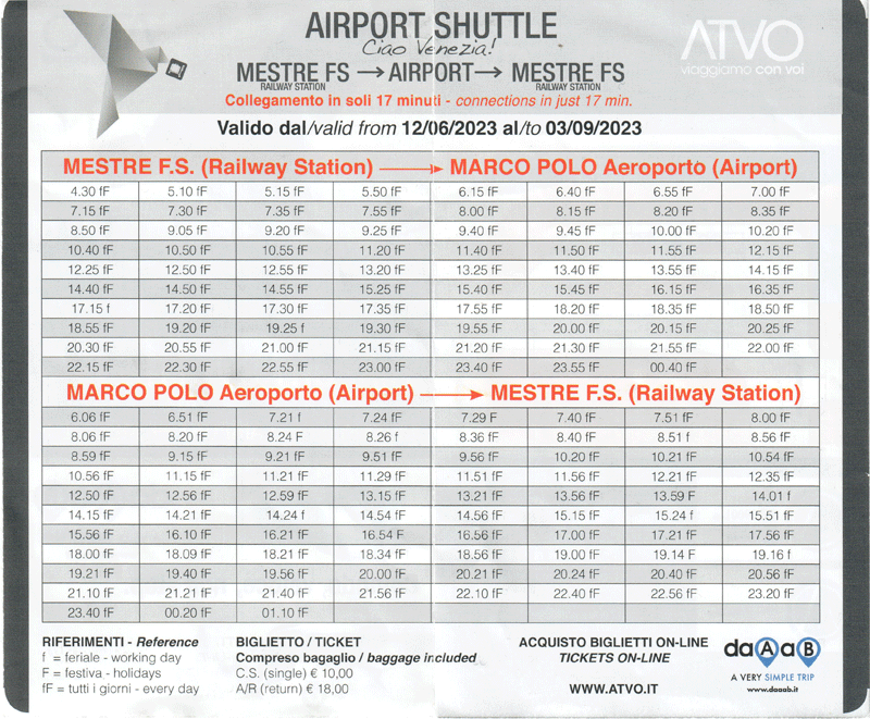
Airport Shuttle Marco Polo Airport - Mestre F. S. (Railway Station) (Euro 15 single 28 return) |
Plaza Hotel,
Viale Stazione 36, 30171
Mestre |
| Sat 19th August |
Cortina Express bus ETD Mestre Station 14-00 hrs ETA Cortina d'Ampezzo 16-00 hrs |
Hotel Ambra,
Via XXIX Maggio 28, 32043
Cortina d?Ampezzo |
| Sat 31st August |
Trentalia train ETD Belluno 10-2hrs ETA Mestre 12-04 hrs
Airport Shuttle to Venice Marco Polo airport.
Ryanair FR795 ETD Venice Marco Polo 16-35 hrs ETA London Stansted 17-50 hrs
|
|
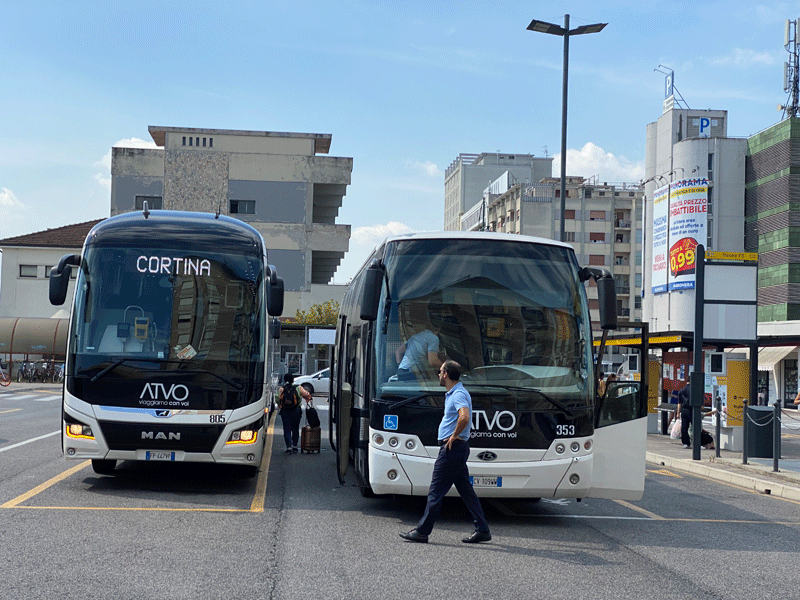
Cortina Express bus station is right next to the railway station at Mestre;
the Plaza Hotel is just visible behind.
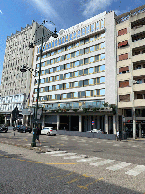
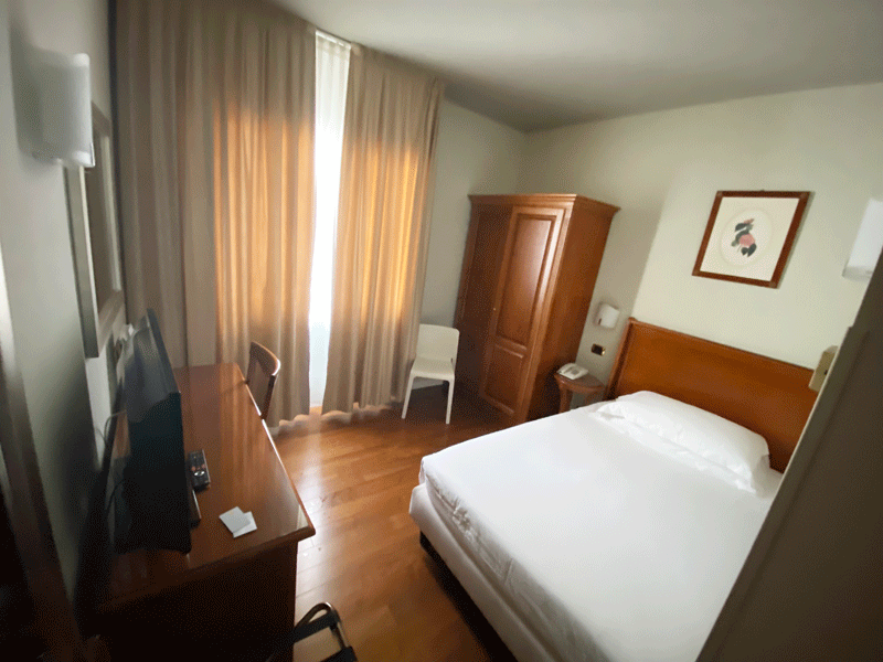
The Plaza Hotel,
Viale Stazione 36, 30171
Mestre
Hotel Ambra
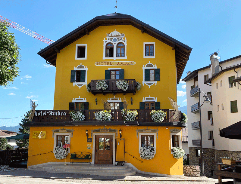
Hotel Ambra,
Cortina d'Amprezzo
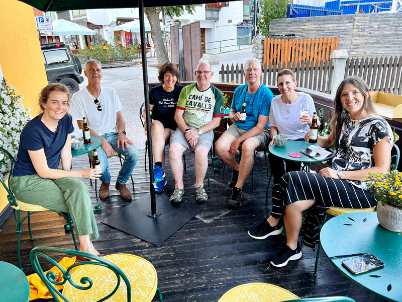
Group meet-up and discussion of the route plan
Left to Right: Dinah, Sandor, Kerri, Ken, Maura and our guide Anna
Unfortunately 2 walkers had had to drop out, so there were just 6 of us plus Anna
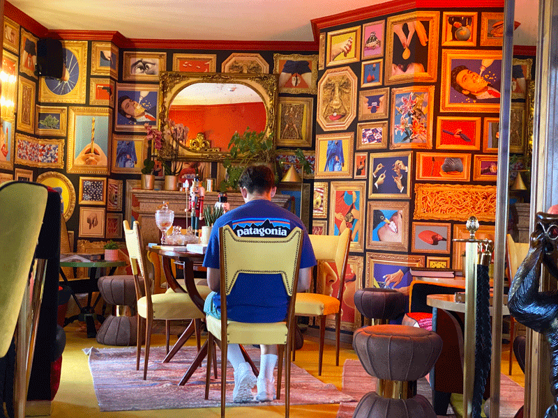
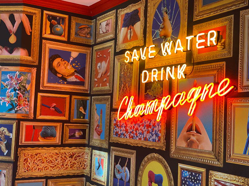
The Bar in the Ambra....... such eclectic wallpaper!

The breakfast room
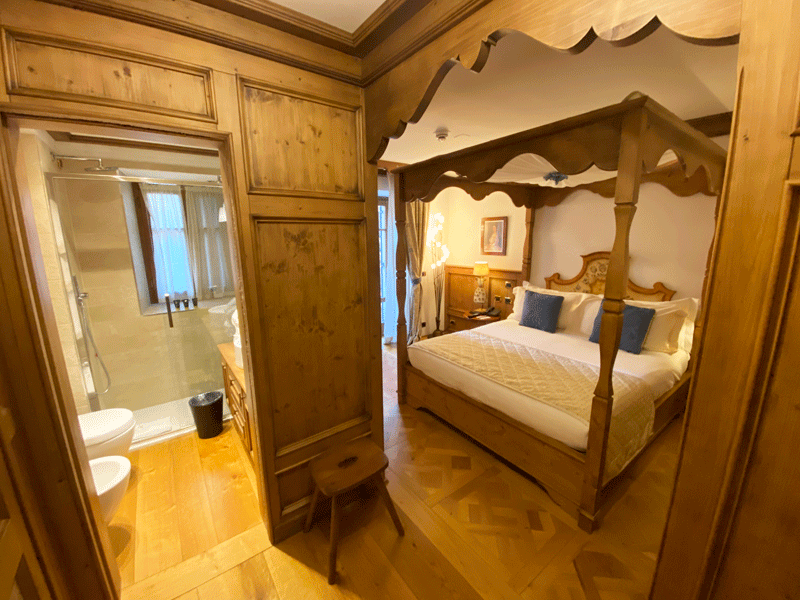
And I told my wife I would be sleeping in refuge accommodation on bunk beds!!
|